Weekly Progress Reports for Construction Superintendents: A Better Approach
If you are a superintendent, your weekly progress report is probably one of the most time-consuming parts of your job. What if it practically wrote itself?
The Reporting Burden on Superintendents
Every week, you walk the site, take photos, compile notes, and try to summarize what happened — all while managing subcontractors, answering to the project manager, and keeping the build on schedule. The reporting burden is real:
- 2–4 hours per week spent on documentation instead of field coordination
- Ground-level photos that don't capture the scale or context of progress
- No easy way to compare what changed week to week
- Stakeholders and owners wanting visuals, not just text summaries
- Subcontractor disputes about scope and timing with no objective record
How Aerial-Captured Progress Reports Work
Instead of documenting the site from the ground up, you start with a complete aerial view and drill down into the details:
Weekly Drone Flight
Our pilot captures your entire site from multiple altitudes. Every zone, every stockpile, every structure — in a single pass.
Processed Into Deliverables
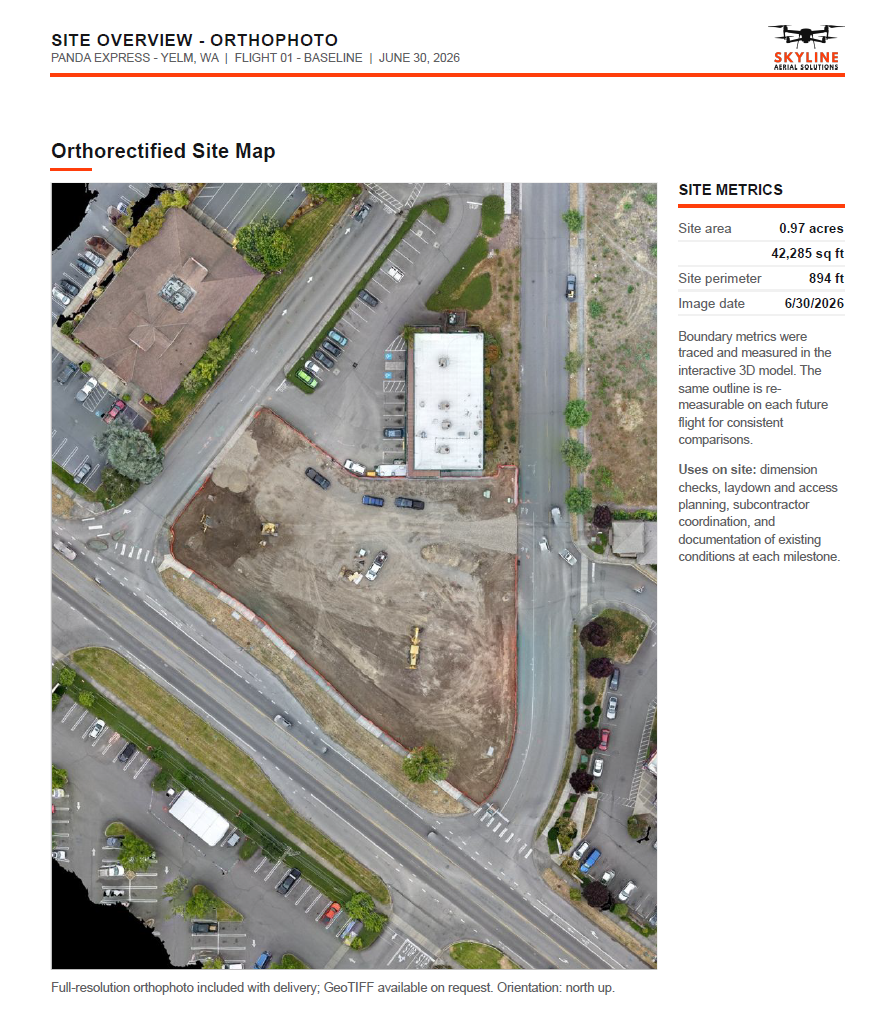
Within 24–48 hours, the flight data is processed and uploaded to your portal — which may include an orthophoto map, 3D model, panoramas, and a formatted PDF report, depending on your selected services.
Self-Service Measurement Tools
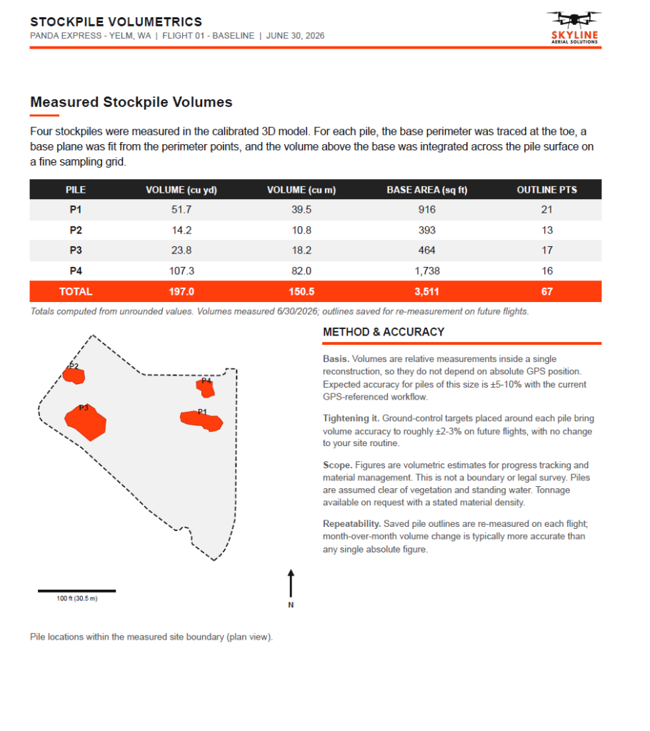
Need to check a distance or stockpile volume? Open the 3D viewer, measure it yourself, and screenshot the result for your report.
Download and Share
Your PDF report is ready to send to the project manager, owner, or subcontractor team — no compilation required.
What a Skyline Progress Report Includes
Each PDF progress report is formatted for professional sharing with stakeholders, subcontractors, and project teams:
Case Study
Chehalis Neighborhood Development
For a full-scale neighborhood construction site in Chehalis, WA — spanning approximately one mile with dozens of crew and 20+ heavy machinery vehicles — weekly aerial reports became an indispensable project management tool.
The team started with an Existing Conditions flight to document roadways before heavy vehicle traffic began. This established a baseline for inspecting and documenting any road damage over the project life.
Initially serviced bi-weekly, the project team upgraded to weekly flights after seeing how the reports streamlined their own reporting workflow. The week-over-week comparisons and measurement-ready data made their progress reports faster to compile and more credible to share with stakeholders.
Self-Service Measurement Tools
Your portal includes measurement tools — no need to call us for a quick check. Open the 3D viewer and:
- Measure point-to-point distances across the site
- Calculate area and perimeter for any zone
- Compute stockpile volumes with a few clicks
- Save annotations for your team to reference later
- Export screenshots directly into your reports and emails
Frequently Asked Questions
Cut Your Reporting Time in Half
Get a quote for weekly aerial documentation of your construction site.