Construction Services
Construction Progress Tracking for Superintendents and Project Teams
Reduce the time spent stitching together ground photos and progress summaries. We document the defined capture area on the agreed schedule and deliver maps, 3D models, and planning-oriented data through a private portal for authorized project-team review.
The Documentation Problem Every Superintendent Faces
As a superintendent or project administrator, you're caught between two demands: keeping the build moving forward and documenting everything that happens on site. Traditional progress documentation means:
- Walking the site with a phone or camera, capturing fragments of the bigger picture
- Spending significant time compiling photos and notes into a report
- Struggling to show stakeholders what actually changed since last week
- Settling subcontractor disputes with incomplete visual records
- Digging through old emails to find a photo from "a few weeks ago"
Ground-level documentation is important — but it doesn't answer the questions that project managers and owners actually ask: How much progress was made this week? Is the grading on track? Are the stockpiles growing or shrinking?
How Weekly Aerial Documentation Works
On each scheduled visit, our pilot captures the defined site area from the altitudes and angles required for the selected services. Processing and portal-delivery timing are stated for the assignment and depend on acreage, deliverables, data quality, and workflow:
Orthophoto Site Maps
Georeferenced, top-down imagery of the captured area with planning-oriented distance and area tools when the selected workflow supports them.
3D Textured Models
Explore visible site conditions from different angles and review spatial relationships without leaving your desk.
Week-over-Week Overlays
Compare dated flights to review visible changes across the captured area, subject to capture conditions and alignment.
Self-Service Measurements
Use planning-oriented distance, area, and selected volume tools in the portal within the documented limits of the deliverable.
PDF Progress Reports
Formatted reports with selected site metrics, methodology notes, and documented limitations — ready to share with stakeholders.
Volumetric Tracking
Where conditions and the selected workflow are suitable, review estimated stockpile and surface changes between flights.
Case Study
Chehalis Neighborhood Development
One of our most extensive ongoing projects is a full-scale neighborhood development in Chehalis, Washington. The site spans approximately one mile from the staging area to the far end of the construction zone, with dozens of crew members and 20+ heavy machinery vehicles operating simultaneously.
Existing Conditions Documentation
Before construction began in earnest, we flew the site to document existing conditions — particularly the roadways surrounding the development. With so many heavy vehicles entering and leaving the site, the team needed a baseline to inspect and document any damage caused by construction traffic over the life of the project.
From Bi-Weekly to Weekly
We initially provided aerial documentation every two weeks. But after the project team saw the value of week-over-week comparison — catching grading issues early, tracking equipment movement, and having a defensible visual record for subcontractor coordination — they requested weekly flights. That voluntary upgrade from bi-weekly to weekly is one of the clearest signals of value we've seen: the client increased their investment because the data was making their job easier.
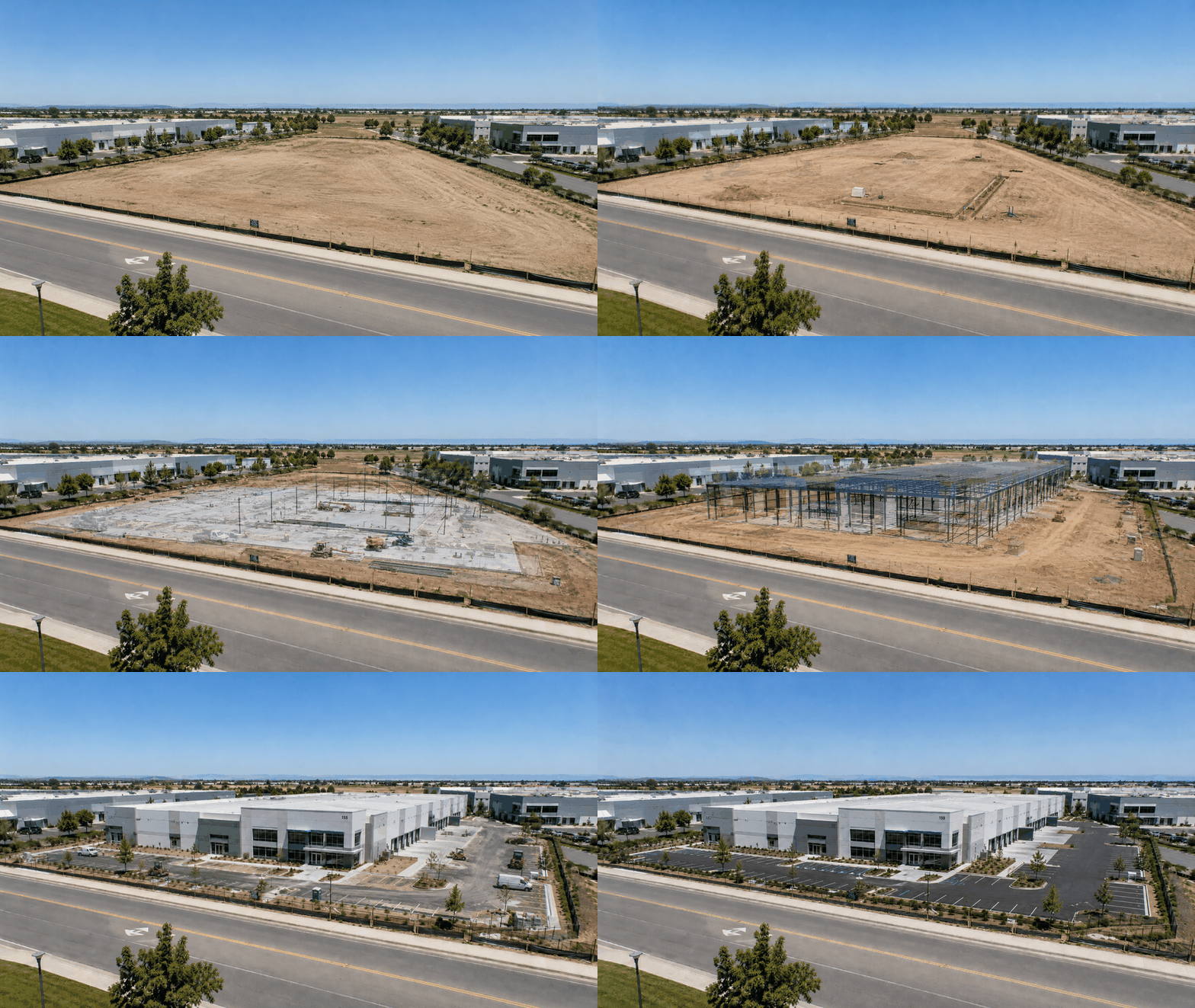
Proven Methodology
The Chehalis project is one of dozens of construction zones we've mapped across Western Washington. Each site has helped us refine our capture methodology, processing workflow, and portal delivery — resulting in consistently high-quality orthophoto maps, 3D models, and progress documentation that superintendents and project teams can rely on.
What Each Flight May Deliver
Your documentation package is built from the services you select. Depending on your plan, each flight may include:
Frequently Asked Questions
Ready to See Your Site From Above?
Draw your site boundary on our map and get an instant quote — no phone tag required.